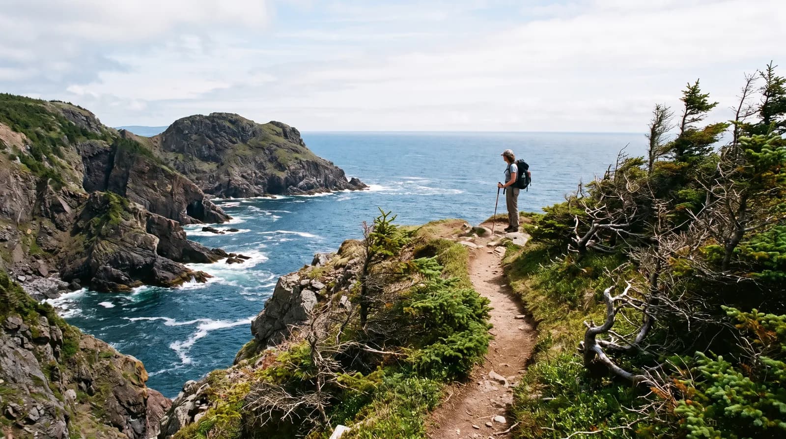
How the trail works
The East Coast Trail runs about 336 km along the Avalon Peninsula, from Topsail Beach, near St. John's, south to Cappahayden. According to the East Coast Trail Association, that total is roughly 270 km of coastal hiking paths plus 66 km of community walks through the towns in between. It is a linear trail, not a network of loops.
The trail is divided into named paths. Each path runs between trailheads, usually at either end of a community. Two points matter for day hikers:
- Distances are one way. A 10 km path is 10 km to the other trailhead. Hiking back the same way doubles it.
- Plan your return. You either walk an out-and-back, leave a second car at the far end, or arrange a pickup. For some paths near St. John's, the association notes that the St. John's Hop On Hop Off bus can drop off or pick up hikers. Check the current schedule and buy tickets before you start, as cell coverage can be patchy.
Difficulty ratings
The association rates each path. In summary:
- Easy: generally 2 to 7 km, with small elevation changes.
- Moderate: generally 4 to 11 km, with climbs of up to about 75 m.
- Difficult: generally 9 to 17 km, with climbs of up to about 150 m and rougher trail.
- Strenuous: long paths with major climbs and few trail structures.
Ratings and conditions can change, so read the current path page and any path advisories before you set out.
Easy day hikes
La Manche Village Path (Tors Cove to La Manche), about 6.4 km, easy. This path ends at the 50 m suspension bridge over the La Manche river, next to the slate foundations of a former settlement. The association lists 2 to 3 hours one way. A popular shorter option is to park at the La Manche end and walk the 1.4 km access path down to the village and bridge.
Beaches Path (Witless Bay to Mobile), about 7.1 km, easy. A shoreline walk with views of offshore islands in the Witless Bay Ecological Reserve, an important seabird nesting area. The association currently notes wet, muddy sections and trail structures needing repair, so check the advisory first.
Father Troys Trail (Flatrock to Torbay), about 8.9 km, easy. Cliff views and a side loop to a kittiwake colony, north of the city. A section through Tapper's Cove has been closed for wharf reconstruction, with a signed detour of about 1 km. Check the path page for current status.
Moderate and difficult day hikes
Sugarloaf Path (Logy Bay to Quidi Vidi), about 8.8 km, moderate to difficult. This is the most convenient full path from downtown St. John's, ending in Quidi Vidi Village. It has two big climbs of about 150 m and views over the city from the south end. The association lists 3 to 5 hours. Use the signed hiker parking lot at Logy Bay, not the Ocean Sciences Centre lot.
Deadmans Bay Path (Fort Amherst to Blackhead), about 10.5 km, moderate to difficult. This path starts near the Fort Amherst lighthouse on the south side of St. John's harbour and climbs over the Southside Hills. The association lists 4 to 7 hours and notes that conditions on the hilltops are often harsher than at sea level. It links on to the Cape Spear Path.
Cape Spear Path (Blackhead to Maddox Cove), about 15.4 km, moderate. This path passes Cape Spear, the most easterly point in North America, then continues south to Petty Harbour-Maddox Cove. It is long for a moderate rating, at 5 to 7 hours by the association's estimate, and it is often windier, cooler and foggier than the city.
The Spout Path
The Spout Path (Bay Bulls to Shoal Bay Road) is the trail's best-known hike and its hardest common day hike. The Spout is a wave-powered geyser on a remote stretch of coast, and the path also passes sea cliffs, sea stacks, a lighthouse and several waterfalls. The association rates it strenuous and lists 6 to 9 hours for the 16.2 km path.
There is no short way in. The association's own figures:
- Bay Bulls to Shoal Bay Road, including the 6.3 km access path: about 22.5 km.
- Bay Bulls to the Spout and back: about 23.4 km.
- Shoal Bay Road to the Spout and back: about 21.6 km.
There are no bailout points. Start early, carry plenty of water and allow time to finish before dark. This path is for experienced, prepared hikers.
What to bring
The association recommends trail-rated hiking boots or shoes on every path. Sneakers and sandals are not adequate. Also bring:
- The official path maps (sold through the association's trail shop and some St. John's retailers).
- Waterproof and windproof layers, a hat and spare socks. Weather on the coast changes fast, and fog can roll in.
- Enough water and food for the full day.
- A charged phone, with the expectation of gaps in coverage.
Open fires are not permitted on the trail. Stay well back from cliff edges, especially in wind or on wet rock.
When to hike
The trail is generally hiked from late spring to fall. The association notes that no path clearing or condition updates happen from November to April, so winter and early spring hiking is at your own risk. Summer is the busiest season. Early fall often brings quieter trails. For the bigger picture, see the best time to visit Newfoundland.
Guided hikes and local operators
East Coast Trail Association volunteers lead public guided hikes on weekends, generally from April to November. You need to pre-register and arrange your own transport. For private guiding, shuttles or multi-day trips, look at local tours and guides.
If you are based in the city, St. John's for first-timers covers what to do on your non-hiking days. Several paths start close to boat tour harbours such as Bay Bulls and Witless Bay, so a hike and a tour can fit into one day.